
In the past we’ve written about great apps for finding your way around cities and towns, but what if your idea of a break is to get away from it all? If you’re more interested in lengthy walks and clear night skies than the nearest bars and next bus back to your hotel, here are some apps to install on your iPhone.
Note that some of these require some kind of data connection; but then quite often these days even when you’re in the middle of dense woodland, you’ll still have a mobile signal…
Weather Nerd
Price: $3.99/£2.99 per year
Size: 13.3 MB
Version: 1.8.1
Developer: All Star Apps
When you’re in the middle of nowhere (for a given value of nowhere, which might just mean a campsite that’s further than your usual minimum distance from a coffee shop), knowing what the weather’s going to do is pretty important. If you’re holed up in a tent, considering going on a day-long hike, you need to be prepared if the sky’s about to drop half an ocean on your head.
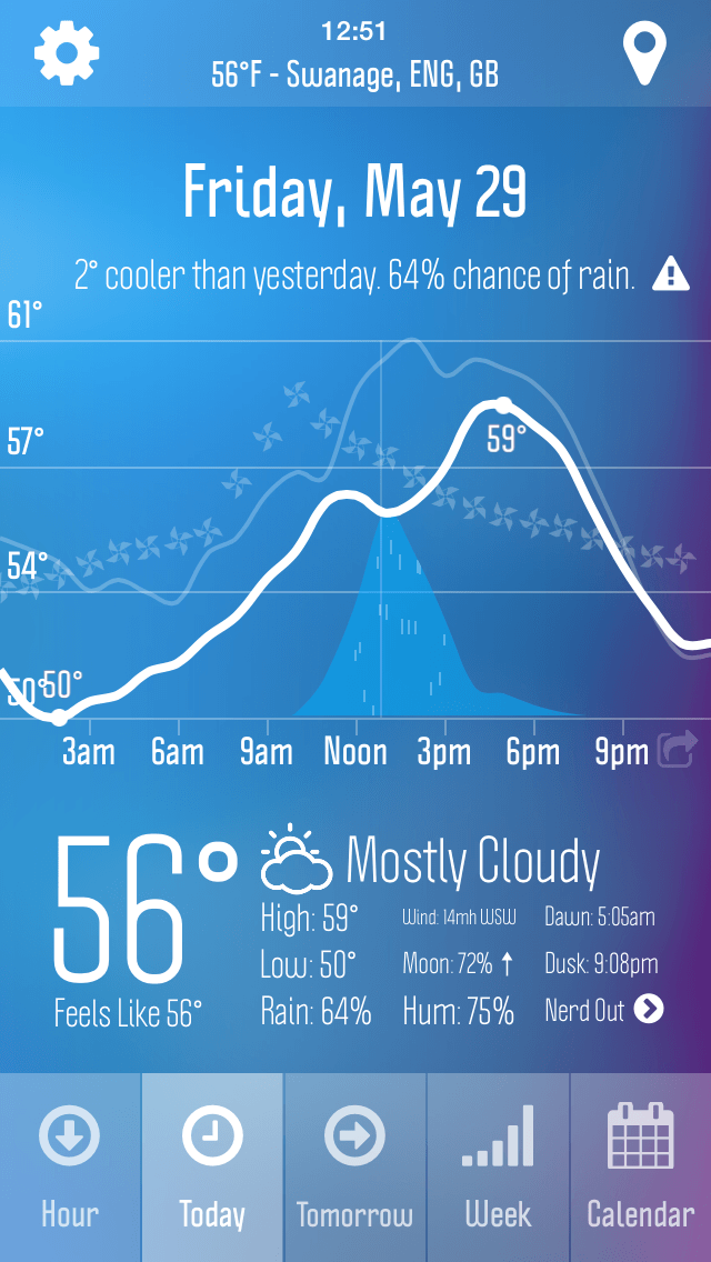
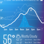
There are so many weather apps available for iPhone now that it requires something special to stand out, and Weather Nerd has what it takes. This is because the app has handy views and intuitive forecasting that’s hugely beneficial when you’re out and about. Tap ‘Hour’ and if you’re in the US, UK or Ireland, you see whether the next hour’s going to be wet or not. (Users in the US also get a radar.) Hit ‘Today’ or ‘Tomorrow’ and you see temperature, rainfall and wind predictions for the day, depicted as an intuitive graph with wiggly lines. Both offer brief comparative overviews, stating whether it’ll be warmer or cooler than the previous day.
As for the ‘nerd’ bit, tap ‘nerd out’ and you get all the weather data you could ever want, including temperature ranges, wind speeds, sunrise and sunset times, visibility, humidity and even ozone readings. Although if you’re thinking you don’t want to leave your cosy tent because the ozone level’s a bit off, you’re probably better off scurrying back to that coffee shop.
-
- Probably not a great time to go for a hike.
-
- The next hour: wet.
-
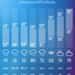
- We’re staying put until Thursday.
Pros:
– Intuitive displays
– Loads of data
Cons:
– Less great outside of the US and UK/Ireland
– Annual payment model might irk some
Google Maps
Price: Free
Size: 28.5 MB
Version: 4.6.0
Developer: Google, Inc.
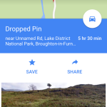
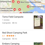
Yep, we’re wheeling out Google Maps again, but that’s because it’s transformed from a comprehensive but simple mapping solution into a versatile travel aid. Clearly, you can use Google Maps to navigate from your home to a countryside destination, but you can do far more than that. Google’s been trying to map the entire world, after all, so often even tiny roads through forests and national parks have Street View, giving you the option to poke around before visiting yourself. The underlying system is also increasingly intelligent regarding search strings; so, for example, type ‘camping in Yosemite’ and prod the first result to get a list of campgrounds in and around Yosemite National Park, complete with reviews.
Other prep work with the app dovetails into it being useful on reaching your destination. An offline mode leaves maps on your device when you’ve no connection, and if the connectivity gods later smile on you and you fancy a change of pace, many (although not all) regions have details of nearby things to do. Prior to travelling, drop a pin, tap and collapse the location bar, and then select Explore Nearby from the sidebar; when actually visiting, just tap the compass icon to zero in on your location before opening the sidebar.
-
- Street View? No streets here, guv.
-

- For when you’re fed up of leaves and mud…
-
- Find places to camp out, under the stars.
Pros:
– Great for virtual scouting missions
– Offline maps
Cons:
– Some slightly oddball UI
– ‘Explore nearby’ not yet universal
ViewRanger GPS
Price: Free + IAP
Size: 11.3 MB
Version: 6.0.5
Developer: Augmentra
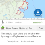
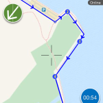
ViewRanger is a route-tracking/finding app for dedicated hikers and cyclists. It utilizes premium topographic maps that can be bought for offline use, or the freely available online OpenStreetMap and OpenCycleMap, which has marked contours. The app doesn’t require a data connection (since your iPhone’s GPS works whether you have a signal or not), but you must be mindful about online/offline mapping, depending on where you plan to travel.
The big plus about the app from a newcomer’s perspective is the clearly thriving community, offering both free and paid trails for download. These appear to drill down to more local levels than equivalents in rival apps, and some come with additional media, such as imagery and audio. Further interesting additions include an Apple Watch app for ‘glanceable’ directions, and a ‘Buddy Beacon’ system for real-time sharing of your location on the map with other ViewRanger users — handy for group hikes. Your walks can be recorded and shared along with photos. However, the interface is, on the whole, a bit of a dog’s dinner, and so you should familiarize yourself with its workings before setting out.
Note that although a ‘premium’ version of this app exists, it’s being phased out for a free + IAP model. This is great for letting you check out a bunch of routes with zero risk, although start buying a lot of offline maps and your outlay can increase rather rapidly!
If you’re willing to take a more immediate chance, Gaia GPS ($19.99/£14.99) is also a highly capable app in this area, with a slightly tidier interface and pay-once model, unless you fancy a pro subscription for map overlays, email support, and a handful of other additional features. But ViewRanger is perhaps a smarter first choice, since you can try before you buy.
-
- Walking and audio. Just don’t fall into the sea.
-
- Not a pretty face — but pretty clever.
-
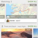
- Nipping to Iceland? No problem — there are trails there too.
Pros:
– Packed with features
– Loads of community input
Cons:
– Complex and messy interface
– Can get quite expensive
Sky Guide
Price: $2.99/£1.99
Size: 103 MB
Version: 4.2.2
Developer: Fifth Star Labs LLC
One of the big benefits of escaping a city is in rediscovering the night sky. Away from the blurry haze of street lamps, shop signs and office buildings that inexplicably keep their lights on all night, you can once again properly see the majesty of the heavens. For many people, that will be enough — settle back, a favored brew within reach, and lose yourself in the cosmos. But if you want a guide to the night sky, Sky Guide is, appropriately enough, a superb app.
Hold the app up and it uses your iPhone’s gyroscope to correctly orient the virtual view, essentially matching the equivalent patch of sky. Illustrative representations of star groupings, along with celestial bodies, subtly fade in and out as you explore; tap an item and you get a succinct page of information. Smartly, although the app will happily automate the sky view it provides, based on your current location, this can also be defined manually. This means if you lack connectivity, you can still discover what planet’s glowing above. The app additionally boasts a powerful search, includes optional notifications, bundles a Today view mini-guide and Apple Watch extension, and has a noodly soundscape that puts you in the mood for mulling over the universe’s mysteries.
Pros:
– Beautiful interface
– Works without Wi-Fi/GPS
Cons:
– Lacks an ‘overlay’ mode
– Nothing else
-

- Look out for the big sky bear.
-
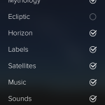
- See only what you want to see.
-
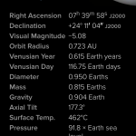
- Learn about those bright things in the sky.
First Aid
Price: Free
Size: 46.0 MB (US) | 38.3 MB (UK)
Version: 2.1.1 | 2.1.0
Developer: American Red Cross | 3 Sided Cube
US:
UK:
If you’re ambling about a city, fall over and damage something, chances are you’ll be able to get assistance pretty quickly. If you’re in the middle of the woods, help might take rather longer to arrive. Under such circumstances, it pays to be well-versed in first aid; if you’re not, it’s a good idea to be armed with relevant information.
‘First Aid’ is in fact multiple apps. We’ve linked to First Aid by American Red Cross (on the US App Store) and First aid by British Red Cross (on the UK App Store), but there are equivalents elsewhere, too — for example, 3 Sided Cube has almost identical apps on the Australian, Canadian and Swiss (as Croix-Rouge) stores. Clearly, the app gets about a bit, just with some minor fiddling and localization regarding emergency numbers, languages and information.
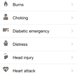
This is hardly surprising, because this is a solid app. Information is broken down into categories — learn; prepare; emergency; test — and step-by-step guides comprise concise text augmented by clear illustrations. When necessary, the app includes further niceties, such as short videos, timers, Q&As, and branching advice paths, for example to ascertain whether someone who’s unconscious is breathing or not.
Pros:
– Plenty of information
– Handy aids peppered throughout
Cons:
– Videos, while built-in, are fuzzy
– No search facility
-
- Fortunately, not a typical holiday checklist.
-

- Smart advice for someone who’s been poisoned.
-

- If you’re bored, test your medical knowledge.
The best of the rest
Capture
$1.99/£1.49 • 0.4 MB • v1.7 • Sky Balloon
Starts recording the second you launch the app, stops when you quit, and sends the resulting video to Photos. Handy to not lose unmissable moments.
Snapseed
Free • 35.9 MB • v2.0.2 • Google, Inc.
One of the finest photo-editors for Mac, and perfect for adding a little pizazz to your latest beautiful landscapes, captured in the wilderness.
Periscope
Free • 12.4 MB • v1.0.4 • Twitter, Inc.
A strange live-broadcast system that integrates with Twitter. A bit niche, but fun to show your friends and followers what you’re currently up to.
Day One
$4.99/£3.99 • 37.4 MB • v1.17 • Bloom Built, LLC
Our favorite iPhone journalling app — beautiful, location-aware, and with image integration. Perfect for recording your adventures during downtime.
Bonjournal
Free • 12.7 MB • v1.1.7 • Bonjournal LLC
An excellent app for recording your travel adventures if you intend to share them with the world. The app makes it easy to collect and present images, text and video.
PeakFinder Earth
$3.99/£2.99 • 45.5 MB • v2.6.0 • Fabio Soldati
One for the mountaineers, this app works online or offline and includes more than 250,000 peak names, which can be displayed on a panoramic view.
Happy Camping
$0.99/79p • 31.5 MB • v1.0 • Random House LLC
This one has a delightful name and some tiny tools for when camping, including a checklist, level, strobe, and sound effects for scaring people around the campfire. AROOOO!
Footpath Route Planner
Free • 19.8 MB • v2.2 • Eric Wolfe
There are plenty of routefinding apps, but we like how this one creates plans from drawn paths. To save them, you’ll need the Elite IAP ($4.99/£3.99).
Download Footpath Route Planner
BootPrint – Pocket Survival
$0.99/79p • 0.4 MB • v3.2 • Leland Roys
If you’ve strayed outside of cell coverage, this app’s designed to direct you towards the most recent strong tower signal.
Heads Up!
$0.99/79p • 94.8 MB • v2.6 • Warner Bros.
Finally, if you’re done with nature and fancy playing a game, Heads Up! requires only one iPhone, and simply tasks you with guessing the word on the card. (You could play this with paper too, obviously, but the iPhone might save everyone pointing torches at your head.)