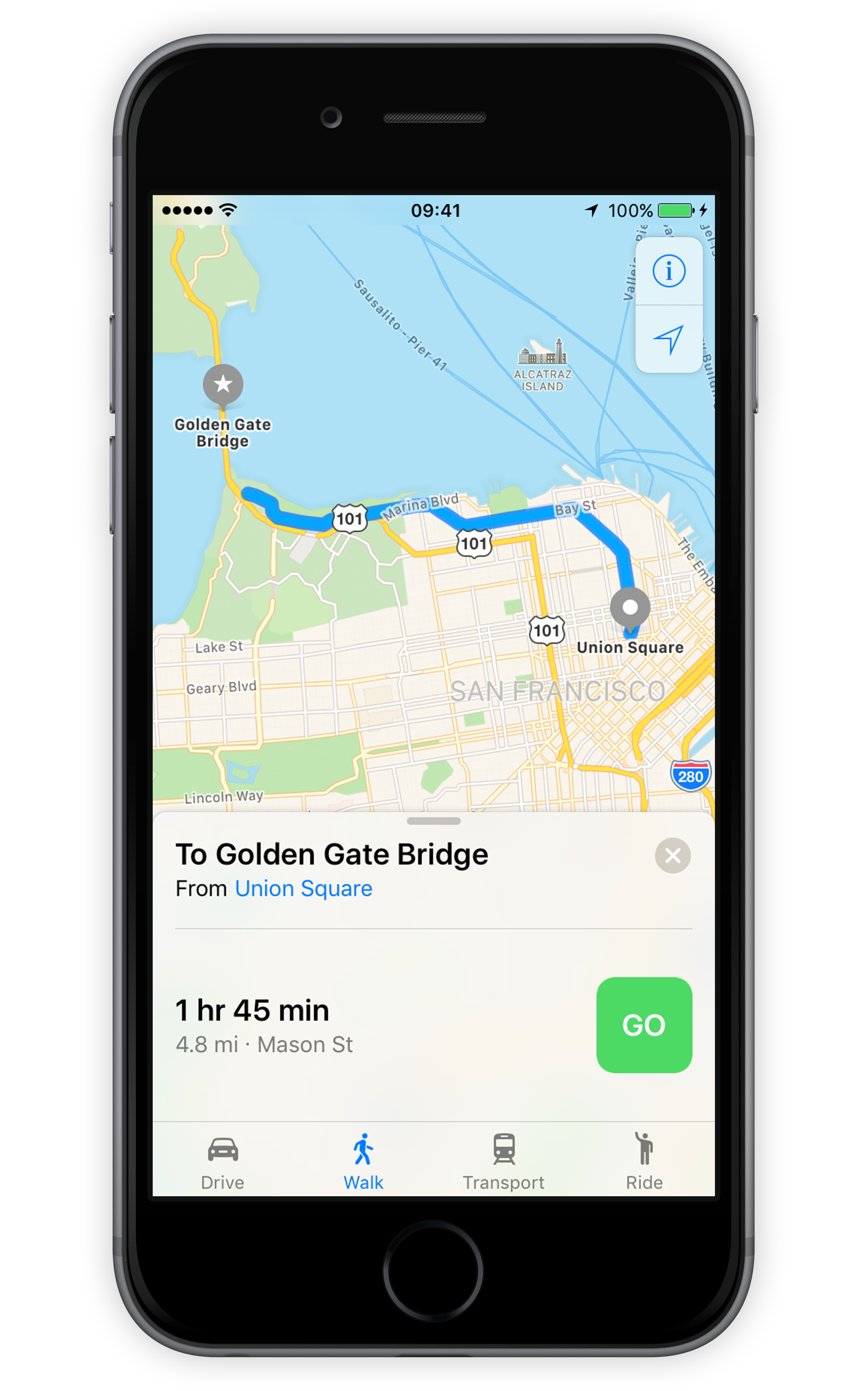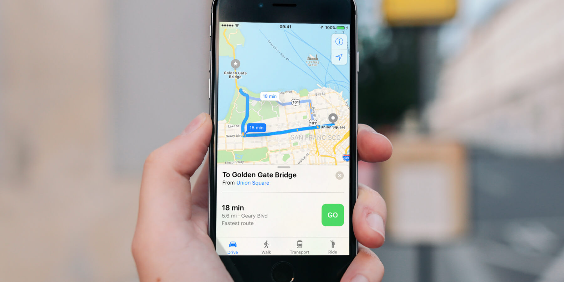

Get quick directions to any point on a map within the Maps app. Tap on a location icon or pin, or type a destination into the search box. An info box will appear at the bottom of the screen. From here tap the blue Directions button. You’ll notice four tabs along the bottom of the app: Drive, Walk, Transport, Ride. Choose your preferred mode of travel and hit the big green GO button.
This will launch step-by-step directions along with a dynamic map view, much like a conventional SatNav.
Transit directions
As well as standard driving and walking directions, Maps includes support for trains, buses and subway systems. Load up a destination, hit Directions, and then tap Transport followed by GO to be given transit directions via public transport. Hit GO to start step-by-step directions.
Once started, the directions proceed on the map in a similar way to the more familiar walking and driving directions. Tap the address tab along the bottom and select Overview or Details for more information on the journey.
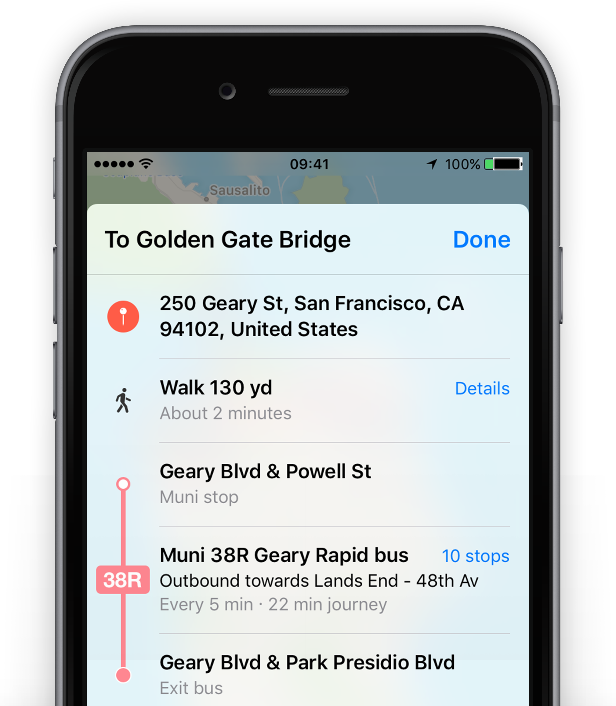
If part of your journey is on the underground, Maps displays an x-ray cut-through view of the station so you know where to walk to find the correct route once you get down there.
Currently transit directions are only available in selected big cities such as New York, Toronto, and London.
Take a stroll
You can also tap the Walk option to get rough walking directions to a destination. However, be aware that these might well send you down major roads without the safety of a sidewalk, so be careful.