

Apple has given its Maps app a total overhaul for iOS 14. Here’s everything you need to know about the new and decidedly more environmentally-friendly Apple Maps.
New and detailed mapping
Apple rolled out a more detailed form of map in the US in 2019. With iOS 14, it’s bringing those detailed maps to more countries later in 2020, including Canada, Ireland, and the UK.
Check out the difference between the old and new style maps below.
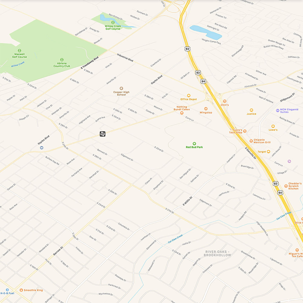
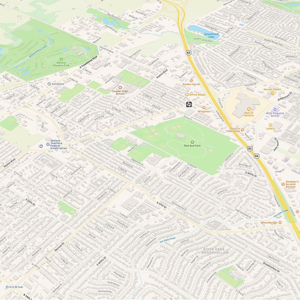
These new maps supply more detail for roads, buildings, parks, marinas, beaches, airports, and more. In short, you get a more realistic view of the world in Maps for iOS 14.
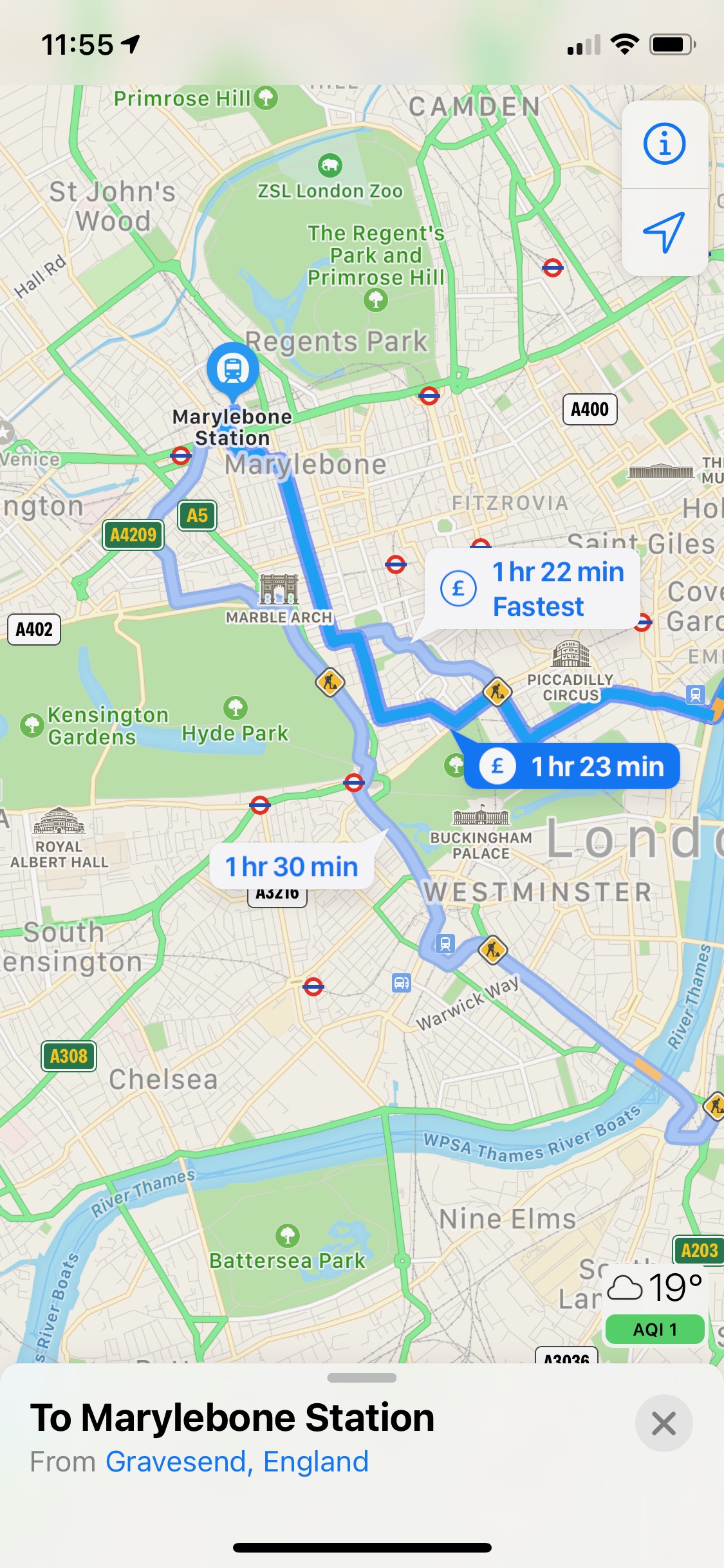
Using City Guides
iOS 14 introduces city guides, which sees expert advice on things to do in the world’s major cities from the likes of Lonely Planet, Zagat, and AllTrails.
Search for a participating city (at launch San Francisco, New York, London, and Los Angeles, with more to follow) within the Maps app. Any available guides will appear as part of that city’s information, immediately below the map.
Drag the city’s information pane up and scroll through the thumbnails to see all the guides for that city. Tap the one that takes your interest.
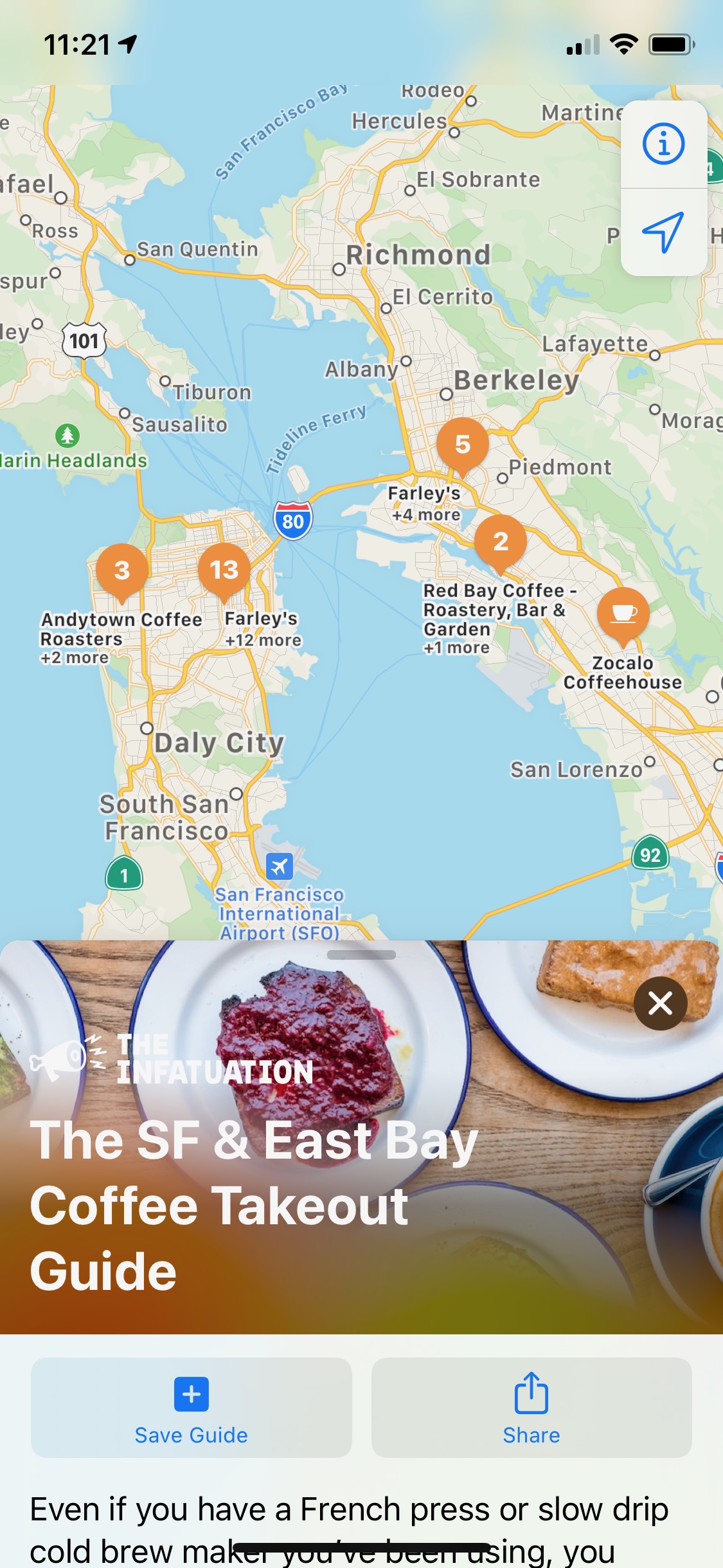
Scroll down for a full rundown of the sights and hotspots listed within that particular guide. Tap on a specific location for more information, or tap the + icon to save that location to a new custom Guide.
All of the key areas mentioned in the guide will be noted on the map above, with the digits denoting the number of places listed for that area. Tap on these numbered pins for a rundown of all the contact details, or for directions.
New green features
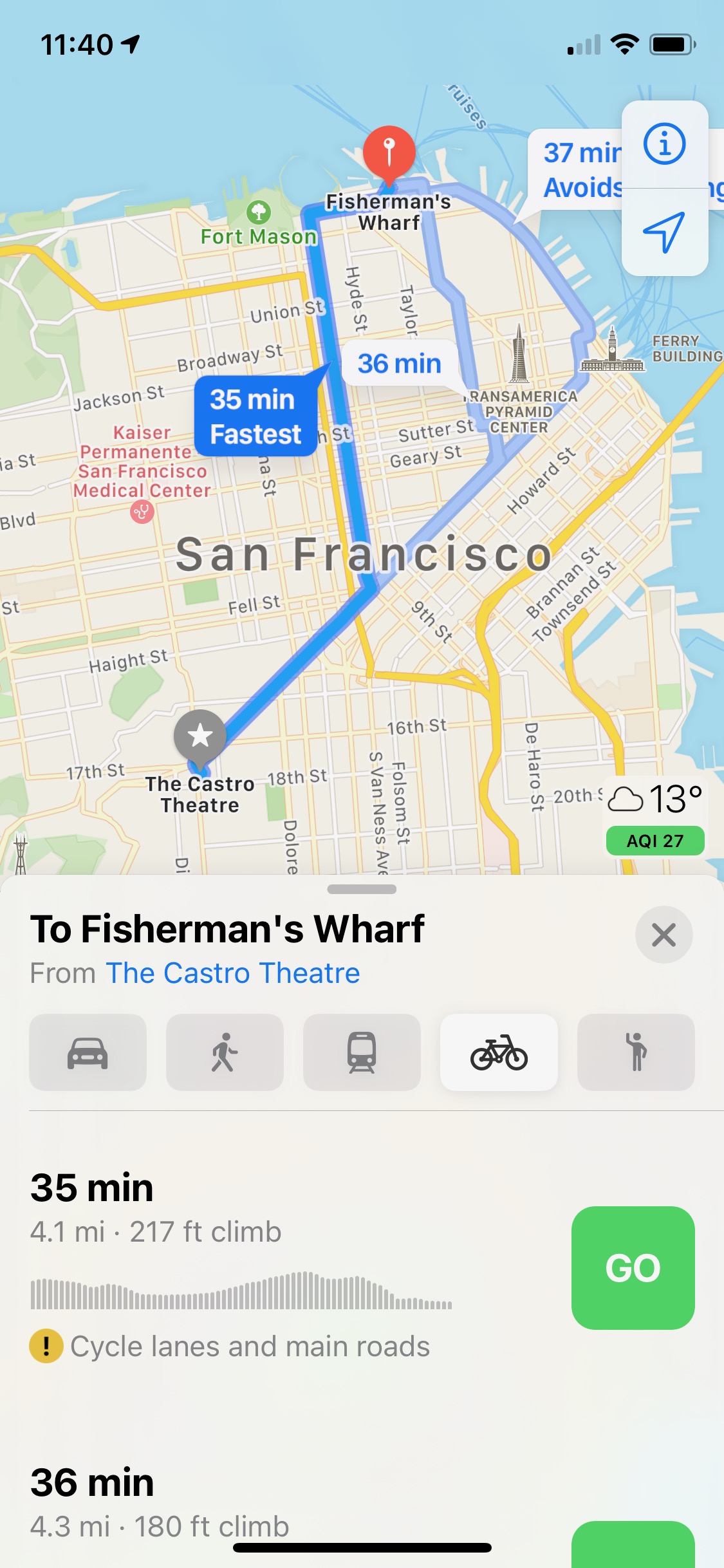
Alongside the usual walking, driving and public transport options, Maps for iOS 14 adds cycling routes for the San Francisco Bay Area, Los Angeles, New York City, Shanghai, and Beijing. More cities will follow.
Start a route as normal in a supported city, and you’ll find that a bike icon is now available to the right of the usual options. Tap that bike icon for several cycling route options, along with information on elevation changes, shared roads, and protected lanes.
Maps now also supports electric vehicle (EV) routing. By adding your specific vehicle model to your device, it will supply information on compatible charging points throughout your route.
Another green feature of Maps in iOS 14 is support for cities with congestion zones, such as London and Paris. It will now show congestion zone tolls on the map, and thus can help you avoid them.
Maps for iOS 14 lets you know when there are speed cameras and red light cameras along your route. It will also show you precisely where these cameras are on the map.
Refine your location
When you can’t get a precise hit on your location in Maps for iOS 14, you’ll be prompted to raise your phone. Your iPhone will then use its camera to scan the skyline to ascertain precisely where you are.
This futuristic Look Around function will only be available in a handful of US cities at launch, including Boston, Chicago, Houston, Las Vegas, Los Angeles, New York, Oahu, Philadelphia, and San Francisco. More cities will be added over time.