
Apple has made a handful of impressive improvements to the Maps app in iOS 15 and iPadOS 15, including immersive walking directions which use the power of augmented reality, enhanced 3D landmarks, and additional options for public transport routes.
Immersive AR walking directions
It’s even easier to follow walking directions thanks to an immersive mode that uses augmented reality (AR). When activated, you can follow directions by pointing your device at the buildings around you, and arrows will appear on-screen which send you down the right street.
As you’d expect, AR mode is available for walking directions only – so don’t go pointing your iPhone at the road while driving! To activate the mode, begin a route and tap the walking icon before hitting GO. Then simply raise your iPhone or iPad and scan the buildings when prompted.

Step-by-step walking instructions will appear in AR mode automatically. This is a far safer way to navigate a busy town or city, since instead of looking down at your device, you’re looking up and around you.
AR walking directions will be available from late 2021 in a handful of supported cities, including London, Los Angeles, New York, Philadelphia, San Diego, San Francisco, and Washington DC.
To access the feature, you’ll need a device sporting an A12 Bionic chip, which first appeared in 2018.
More detailed cities
Landmarks in major cities can be viewed in immersive detail within the Maps app, along with 3D representations of trees, buildings, and more. Navigate to a landmark, either by dragging your finger around a city until you find one or using the search interface, and tap 3D in the top-right corner.
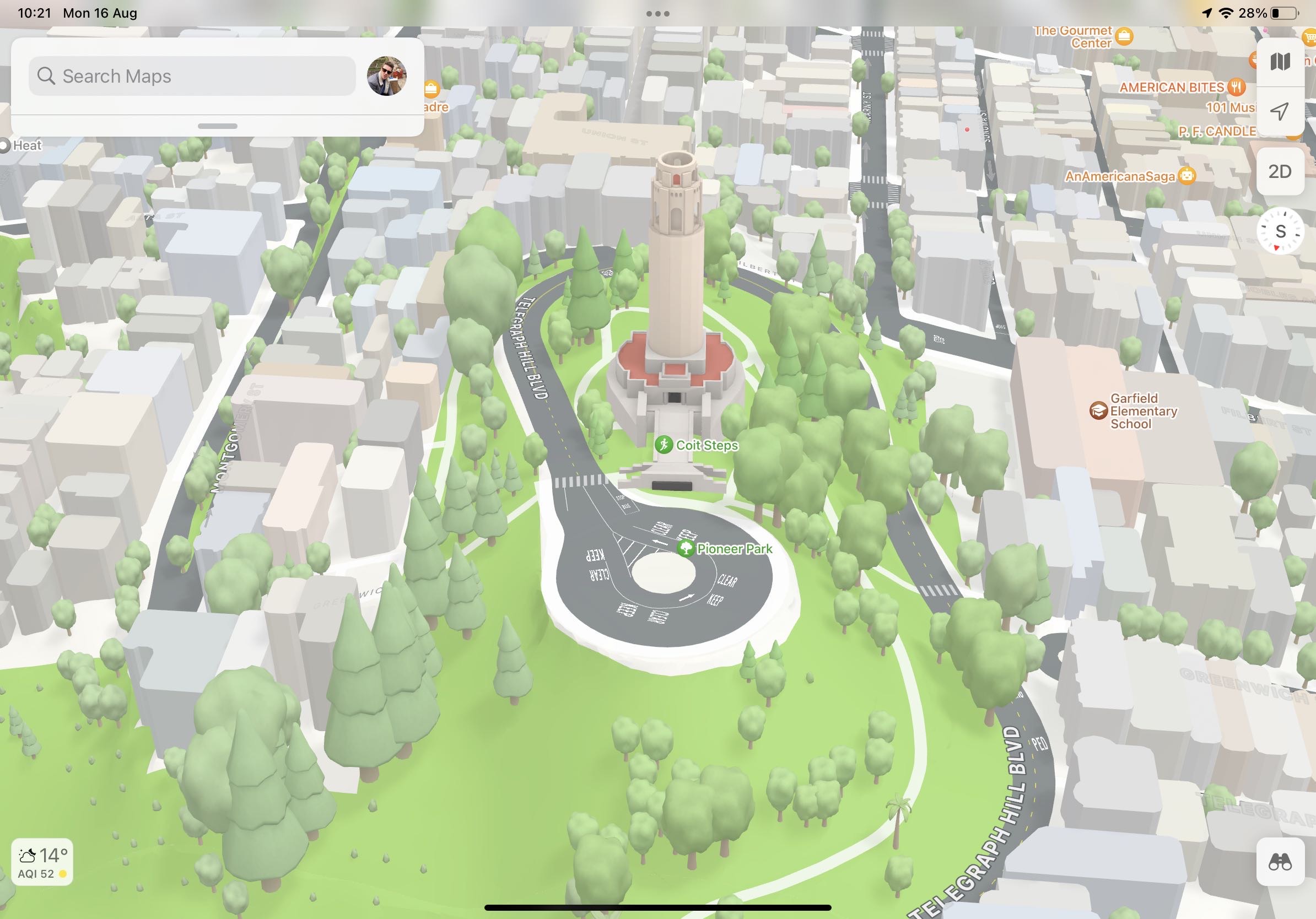
You’ll then be able to look at the surrounding architecture in colorful 3D detail. Don’t forget that you can adjust the viewing angle by dragging two fingers up and down the screen, or you can pan around using a single finger.
Pin favorite public transit routes
If you often use public transport to get around, it’s possible to pin your favorite public transport routes.
In Maps, locate the Favorites area and tap More. Then under Siri Suggestions, tap Nearby Public Transport.
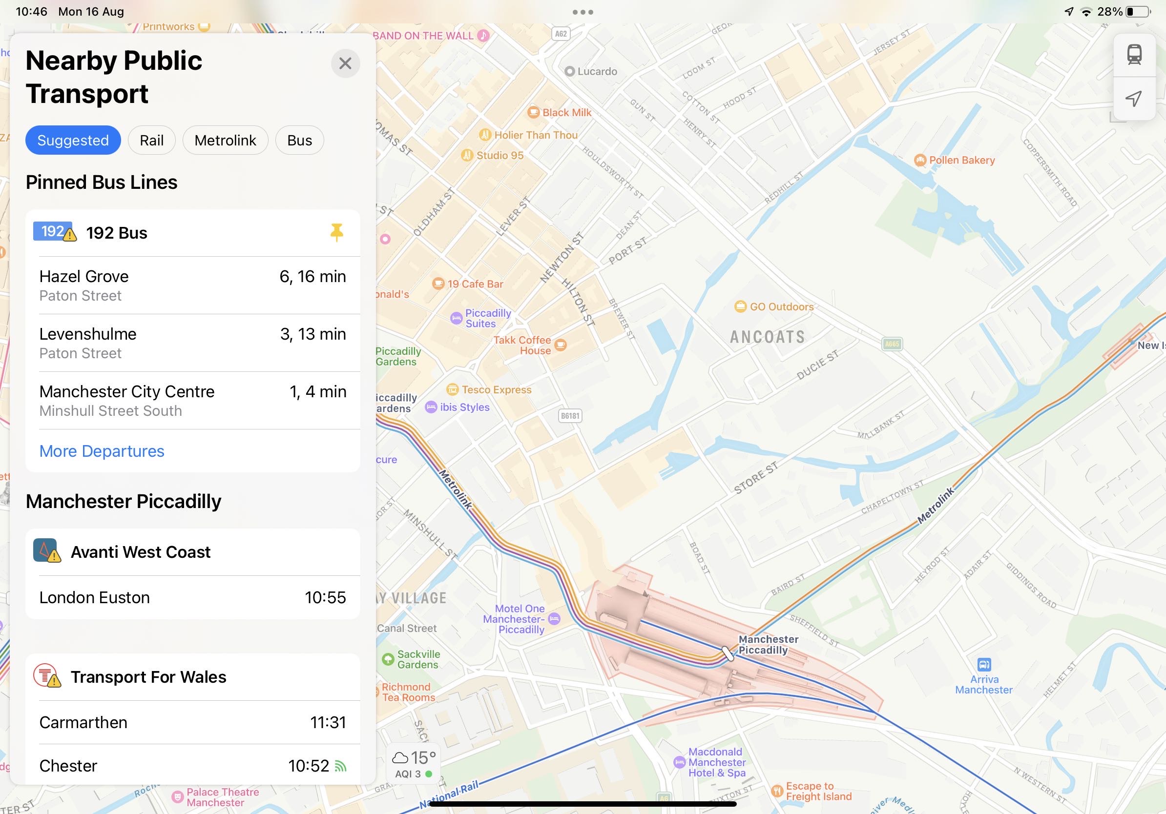
You’ll then be able to see a range of nearby public transport options by trapping the train icon in Favorites. To pin a preferred line or route, simply swipe right and it will be pinned to the top of this interface for easy access.
To unpin a route, simply swipe the other way!